


 Live Makkah
 Live Madinah
 Urdu Font Download


Latest News:
Padubidri: Fishing boat capsizes; all 7 fishermen on board rescued Alleged atrocity on lawyer: Punjalakatte SI suspended Moral policing at jewellery shop: 4 arrested Bajrang Dal activists try to assault youth, girlfriend in Mangaluru SC to hear Bilkis Bano’s plea against release of 11 convicts on 13 Dec Nusrat Noor: First Muslim Woman to Top Jharkhand Public Service Commission
Heavy rain likely for next two days in parts of State


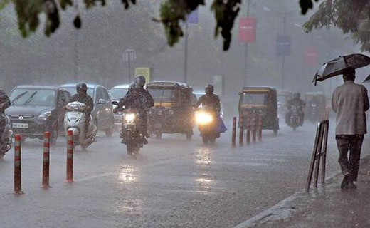
Bhatkal, 02 Dec 2019 [Fik/News Sources]: Coastal and South Interior Karnataka are likely to witness heavy to very heavy rainfall for the next two days, as a low pressure area was forming over South-East Arabian Sea on Sunday morning.
Mangaluru and adjoining areas that witnessed a cloudy sky since morning on Sunday began receiving light showers by evening.
India Meteorological Department said that the low pressure, near Lakshadweep Islands, is likely to move to East-Central Arabian Sea with gradual intensification into a depression during the next three-four days.
In view of this development, strong winds and squally weather are likely to prevail over South-East and adjoining East-Central Arabian Sea, Lakshadweep-Comorin area and along and off Kerala-Karnataka coasts during the next 48 hours.
Also, due to convergence of strong north-easterly winds, the prevailing heavy to very heavy rainfall activity over Tamil Nadu is very likely to continue during the next two days.
Other areas
Heavy-very heavy rainfall is likely to occur in isolated places in Kerala, Lakshadweep and Coastal and South Interior Karnataka during the same period.
Courtesy:The Hindu


Prayer Timings
| Fajr | فجر | |
| Dhuhr | الظهر | |
| Asr | أسر | |
| Maghrib | مغرب | |
| Isha | عشا |
Fikrokhabar is not just an online newspaper rather, this is an institution and its main objective is to use media and innovative technologies to spread Allah's message of love and truth to humanity, youth and scholars, offering the right solution to educational, cultural and social issues related to social society. Along with successfully doing a great service, we are also preparing the new generation for the right leadership of the nation by moving ahead in the academic field.